Solution
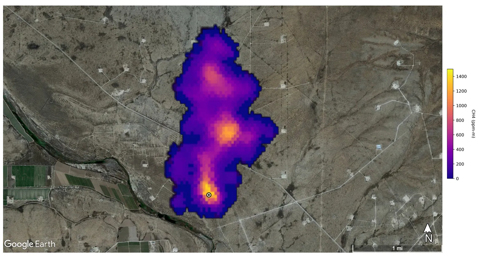
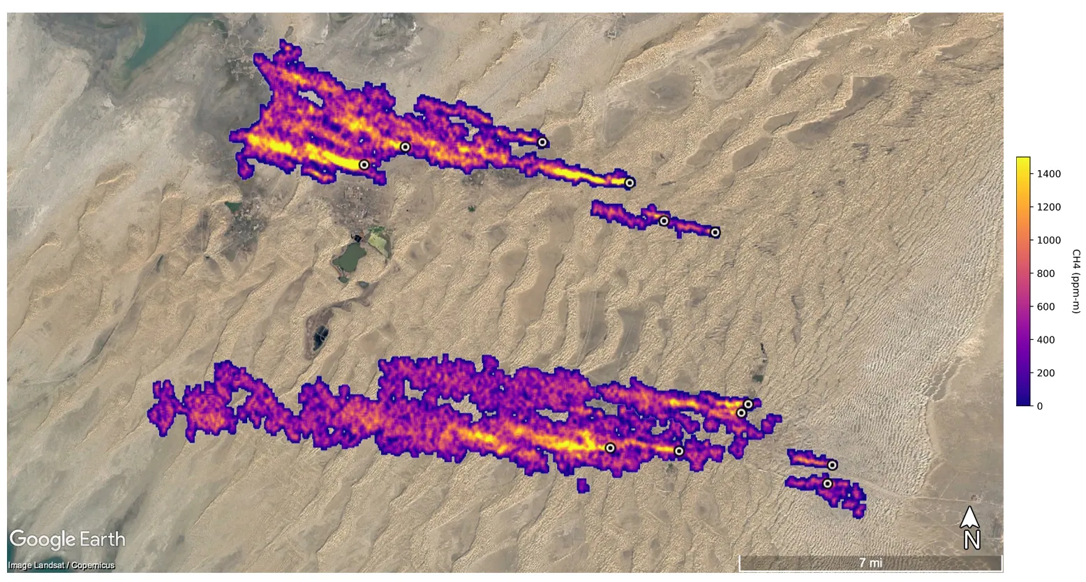
To address these challenges, organizations are leveraging satellite technology combined with artificial intelligence to monitor emissions more effectively. Climate TRACE, for example, integrates satellite imagery with AI to detect and quantify emissions from various sources, including oil and gas fields, steel plants, and transportation networks. This method provides real-time, high-resolution data, enabling precise identification of emission hotspots.
Additionally, agencies like NASA are employing satellite-based systems to monitor specific greenhouse gases such as methane and carbon dioxide. These systems assist in identifying gas leaks, managing forestry resources, and controlling landfill emissions, thereby contributing to more effective emission reduction strategies.